GPS Satellite Maps: Live Earth
- 3.8
- Rating
- 10.00M
- Installs
- Free
- Price

 Analysis by App-foxy
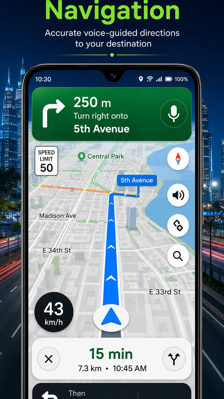
I approached GPS Satellite Maps: Live Earth as a practical navigation and map-viewing tool rather than as a replacement for every mapping service on my phone. Its main appeal is straightforward: it brings satellite imagery, location viewing, route navigation, and route tracking into one free app. That combination makes it useful when I want a quick visual sense of an area, need to follow a route, or want to keep an eye on where I have traveled.
The app comes from Digital App Valley and sits in the Maps & Navigation category. It is free to install, suitable for Everyone, and supports devices running Android 7.0 or later. The current version is 5.0.2, while optional purchases cost $2.99 per item. With more than 10 million installs, it is clearly not an obscure experiment, although its average rating of 3.8 from roughly 39K ratings suggests that the experience is useful for many people but not perfectly smooth for everyone.
Where the experience usually gets stuck
My first impression is that the hardest part is not understanding the basic idea. The harder part is making sure the map view, location signal, route display, and movement tracking are all behaving as expected at the same time. A satellite map can look convincing even when the phone has not yet found a reliable position, so it is easy to assume the app is broken when the real problem is simply that the location has not settled.
You May Also Like

 AccuWeather: Weather Radar
AccuWeather Review: A Quick, Clear Forecast for Everyday Decisions
For everyday plans, the best forecast is the one you can understand quickly. AccuWeather makes rain timing, radar, and local conditions easy to act on, with a few trade-offs.

 Hill Climb Racing
Why Hill Climb Racing Still Turns Crashes Into One More Run
A tiny car, a bumpy hill and one more upgrade: Hill Climb Racing keeps resurfacing because its simple chaos makes every near-miss feel personal.

 AliExpress - Shopping App
AliExpress Makes Global Shopping Feel Personal, but Shoppers Bear the Risk
AliExpress turns a global marketplace into a pocket-sized discovery engine. Its reach is useful, its shopping loop compelling, and its trade-offs easy to miss.

 Lords Mobile: Kingdom Wars
Lords Mobile Is a Kingdom-Building Routine, Not a Quick Match
A case-by-case verdict on the building, battles, device demands, and social commitments that make Lords Mobile rewarding for some players and exhausting for others.

 PDF Scanner app - TapScanner
TapScanner Makes Paperwork Easier to Capture, Check, and Share
TapScanner makes scanning with a phone feel less like a rescue operation and more like a dependable step in getting work done. Its capture tools are useful, though not flawless.

 Block Blast!
 Shows How Much a Puzzle Game Can Leave Out
A quiet grid game shows why puzzle players increasingly value instant clarity, repeatable skill and low-pressure play—and where the genre still needs to catch up.
More From Our News Desk
View All News


That distinction matters. If the map opens but the position marker is slow to appear, jumps around, or remains broadly placed, I would first treat it as a location or signal issue rather than immediately blaming the application. Buildings, underground areas, dense streets, poor reception, and the phone's own location settings can all affect the result. Moving into a more open area and waiting briefly is often more useful than repeatedly tapping the same control.
Another point of friction is the difference between looking at a satellite image and using a route. Satellite imagery is excellent for recognizing large features such as fields, coastlines, parking areas, paths, and building layouts. It is not automatically a live camera view of the road, and it should not be treated as a guarantee that every visible feature is current. I found the imagery most valuable as visual context around a route, not as the only source of driving decisions.
Route tracking can also confuse new users because planning a route and recording movement are different activities. A planned route tells me where I intend to go; tracking is about following or recording progress as I move. If the route seems correct but the movement line does not update, I check whether tracking was actually started and whether the phone still has a dependable position. That simple distinction prevents a lot of unnecessary troubleshooting.
On a normal day, I would use the app before leaving home rather than waiting until I am already moving. This gives the map time to load, lets me inspect the general area, and makes it easier to notice whether the location marker is behaving normally. It is a small habit, but it reduces the chance of trying to solve a setup problem while walking, cycling, or driving.
What I check before trusting a route
I do not rely on the first screen alone. I look at the route shape, compare it with the surrounding satellite view, and check whether the starting point is where I actually am. If the route begins several streets away, I correct the starting position before moving. A route that is technically calculated but starts from the wrong place can create more confusion than no route at all.
I also zoom in before following unfamiliar turns. Satellite imagery can reveal a broad entrance, a long driveway, a divided road, or a nearby open space that is easy to miss on a simplified map. This is one of the app's more useful strengths: it gives me visual clues that a conventional line-and-arrow view may not communicate as clearly.
At the same time, I keep expectations realistic. I would not use this app as my sole authority for urgent driving directions, road closures, or highly time-sensitive traffic decisions. Its strongest role is visual orientation and route awareness. For live traffic intelligence, detailed transit planning, or a mature turn-by-turn ecosystem, a dedicated mainstream navigation service may be the better choice.
Setup checks that save time
The initial setup is easier when I treat it as a short checklist instead of opening the app and immediately starting a journey. I confirm that the device's location function is active, then allow the app to use the location information it needs for navigation and tracking. If the phone is in a restricted battery mode, I also check whether that mode is interfering with movement updates.
I avoid testing the app for the first time in a basement, enclosed garage, or narrow indoor space. Those places are poor environments for judging map accuracy. An outdoor test in an open area gives a much clearer answer about whether the phone can establish its position and whether the map marker responds properly.
Network access is another practical consideration. Satellite imagery and route information may need time to load, especially when I move quickly between areas or start from a weak connection. If the map looks incomplete, I wait for the selected area to finish loading before assuming that the route itself has failed. Closing and reopening the app too quickly can make the situation harder to read because the screen may not have had enough time to finish its work.
I also make sure the phone has enough battery for the task. Map viewing and location tracking are demanding activities, particularly when the screen stays on for a long time. This is not a special flaw of Digital App Valley's app; it is a general trade-off of using a phone as a navigation device. Still, it affects whether the app is sensible for a long outing.
The free price makes it easy to try without committing money upfront. Optional purchases are listed at $2.99 per item, so I would review any purchase prompt carefully and decide whether the added option is genuinely useful for my routine. I would not buy anything simply to solve a basic location problem, because a purchase is unlikely to fix a disabled location service, weak signal, or an incorrect starting point.
A sensible first test
My preferred first test is short and controlled. I open the app at a familiar outdoor location, wait for the position marker, switch to the satellite view, and compare what I see with the real surroundings. Then I create a short route to a nearby destination and watch whether the position updates as I move. This test separates three things that are often mixed together: map imagery, route calculation, and live tracking.
If the satellite layer is clear but the marker is wrong, I investigate the phone's location behavior. If the marker is accurate but the route is unsuitable, I inspect the route itself and the destination. If the route appears correctly but movement stops updating, I check tracking status, battery restrictions, and signal conditions. Testing in this order makes the problem much easier to identify.
One non-obvious benefit of this approach is that it creates a personal baseline. I learn how quickly the app responds on my device and in my usual area. Later, if a route behaves differently, I can recognize whether the change is caused by the surroundings or by the app session rather than guessing.
Recovering a route when the workflow breaks
When something goes wrong during a trip, I prefer a calm reset instead of repeatedly changing several settings at once. First, I stop moving if it is safe to do so. Then I check whether the map still shows my position, whether the route remains visible, and whether I am looking at the correct destination. These three checks tell me whether I have lost location, lost the route display, or simply taken a different path.
If the marker has stopped updating, I move to a clearer location and give the phone a moment to reacquire its position. If it returns, I continue only after confirming that the marker matches my actual surroundings. A frozen or delayed marker is not something I would ignore while navigating an unfamiliar area.
If the route itself seems to have disappeared, I recreate the route from the current position rather than trying to force an old starting point to work. This is especially helpful after a detour. A route planned from home may no longer make sense once I have already passed several turns, so rebuilding from where I am can be cleaner than trying to recover the original plan.
For tracking, I check whether the recording action is active before assuming that the trip has been lost. I also avoid switching rapidly between map views while the app is still responding. My practical rule is to change one thing, wait, and observe. That sounds basic, but it prevents a confusing chain of actions where I no longer know which change helped.
For a walking trip, I would use the satellite layer to identify entrances and open spaces, then rely on the route and my surroundings together. For a cycling trip, I would inspect the route before starting and avoid making screen adjustments while moving. For driving, I would prepare the route while parked and keep the phone positioned so that it does not become a distraction. The app can support these workflows, but safe use still depends on how the phone is handled.
Why restarting is not always the best first move
Restarting the app can help after a temporary display problem, but I do not make it my first response every time. If the real issue is weak location reception, reopening the app changes very little. If the map is still loading, restarting may interrupt that process. I first identify what has failed, then choose the smallest correction.
A useful recovery sequence is to verify the device location setting, move outdoors if possible, wait for the marker, and then rebuild the route if the current position has changed. This sequence addresses the most common layers in the correct order. It also avoids wasting time searching for advanced controls when the phone simply cannot establish a stable position.
I would also take a screenshot or note the destination before experimenting with resets on an important journey. That is not a special feature claim; it is a sensible precaution. If the route needs to be recreated, having the destination ready makes the recovery faster and reduces the chance of entering the wrong place.
When the app is not the cause
Map apps are often blamed for errors that begin with the environment. A tall building can make a position appear late or imprecise. A covered walkway can interrupt updates. A phone with aggressive battery management may reduce background activity. A poor connection can leave imagery looking unfinished. In each case, the app may only be displaying the limits of the device and surroundings.
I pay particular attention to whether the problem follows me outside the app. If other location-based services also struggle to find me, the cause is probably broader than this one application. If the phone's position is reliable elsewhere but this app alone behaves badly, then restarting the session, checking its current state, or reinstalling it becomes more reasonable.
Satellite imagery creates another possible misunderstanding. A visible road, building, or path may not represent today's conditions. Construction, temporary closures, private access, and seasonal changes can make the image less useful than expected. I use the imagery to understand layout, not to assume that every visible route is open or suitable.
This is why I would not recommend the app to someone who needs a complete professional navigation platform with every possible live-data layer. People who depend on detailed public transport departures, sophisticated traffic avoidance, frequent business updates, or highly specialized outdoor mapping may be happier with an app built specifically around those needs. GPS Satellite Maps: Live Earth is more appealing to users who value a visual Earth view and straightforward route awareness.
It is also not the ideal choice for someone who wants an entirely offline workflow. I would prepare important journeys while connected and avoid assuming that every map area or route will remain equally available without a network. The app's concept is most comfortable when I can load the map, check the route, and confirm my position before setting out.
Who gets the most from it
I think the app suits curious travelers, walkers, casual cyclists, drivers who want a satellite perspective, and anyone who likes checking an unfamiliar area before visiting. It is particularly handy for examining the relationship between roads, buildings, fields, and entrances. A person planning a visit to a large venue or rural destination may find that visual context more helpful than a plain route line.
It can also work well as a secondary map tool. I might use a conventional navigation app for detailed live directions, then open this one to inspect the surrounding layout or understand why a route approaches a destination from a particular side. That combination gives each app a clearer job instead of expecting one tool to handle every mapping task.
I would skip it if my priority is a polished, all-in-one navigation system with the deepest traffic, transit, or offline capabilities. I would also be cautious if I dislike troubleshooting location behavior or if I need guaranteed precision in difficult environments. The 3.8 average indicates a mixed experience, and that matches my view: the app can be genuinely useful, but it rewards users who understand what satellite imagery and phone-based positioning can and cannot do.
My practical verdict after using it
GPS Satellite Maps: Live Earth is a worthwhile free map app when I want more than a basic road diagram. Its satellite perspective helps me understand places visually, while route navigation and tracking give the app a practical purpose beyond simply browsing the planet. The experience is strongest when I prepare the route, test the location marker, and use the imagery as supporting context rather than treating it as an unquestionable live record.
The main trade-off is consistency. A successful session depends on the phone's location signal, network conditions, battery behavior, and the clarity of the route workflow. Those factors can make the app feel excellent in one setting and frustrating in another. I found that most problems became easier to handle once I separated map loading, positioning, route planning, and tracking instead of treating them as one feature.
Digital App Valley's app is therefore best viewed as a practical companion rather than a universal replacement for established navigation services. Its free entry point, Everyone age rating, and broad device support make it easy to test, while the optional $2.99 purchases leave room for users to decide whether they need anything beyond the basic experience.
My recommendation is simple: try it for satellite-based orientation, short route checks, and visual planning, but test it in your normal surroundings before trusting it on an important journey. If you want to see how a destination is laid out and follow your movement with that visual perspective, it earns a place on the phone. If you need the most dependable live traffic, transit, or offline navigation system, I would pair it with—and in some cases choose instead—a more specialized alternative.
FAQs for GPS Satellite Maps: Live Earth
01What features does GPS Satellite Maps: Live Earth offer?
GPS Satellite Maps: Live Earth provides real-time satellite imagery, detailed street maps, and 3D terrain views. Users can explore any location worldwide, use the app for navigation, and view live traffic updates. The app also includes a street view option, enabling users to explore cities and landmarks in high definition.
02Is GPS Satellite Maps: Live Earth available offline?
The app primarily relies on an internet connection to provide real-time data and map updates. However, some features, like saving specific map areas for offline use, may be available. It’s advisable to check within the app settings or manual for offline capabilities to ensure seamless navigation without connectivity.
03How accurate is the location tracking in GPS Satellite Maps: Live Earth?
The app utilizes advanced GPS technology to offer precise location tracking. However, accuracy can vary based on factors such as signal strength, device capabilities, and environmental conditions. For the best results, users should ensure their device's GPS is enabled and has a clear view of the sky.
04Does GPS Satellite Maps: Live Earth consume a lot of mobile data?
Since the app provides live satellite imagery and traffic updates, it can consume a significant amount of data. Users concerned about data usage should connect to Wi-Fi when possible or monitor their data consumption within the app settings. The app may offer options to reduce data usage.
05Is GPS Satellite Maps: Live Earth free to use, or does it require a subscription?
GPS Satellite Maps: Live Earth is available as a free download, offering basic features at no cost. However, it may offer premium features or an ad-free experience through in-app purchases or a subscription model. Users should review the app’s pricing details on the app store page before downloading.
Pros
- High-resolution satellite imagery
- Real-time location tracking
- User-friendly interface
- Offline maps available
- Regular updates with new features
Cons
- Consumes significant battery power
- Requires stable internet for best use
- Ads can be intrusive
- Limited features in free version
- Some areas lack map detail

GPS Satellite Maps: Live Earth
Gallery